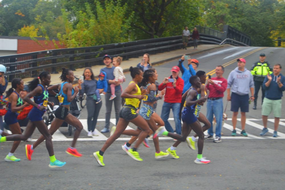
Get ready to line the Boston Marathon route and cheer on the fleet of foot—the storied race comes through Wellesley (and seven other towns along the 26.2-mile route) on Monday, April 18.
Roads along the route will close at 8:30am on race day. Once the roads are closed, motor vehicles may not cross the race route.
Roads will remain closed until the end of the race. The estimated time for reopening the roads is 3:30pm, but that’s an inexact science.
In addition, there will be some temporary no parking areas that will be posted close to the Marathon route. Vehicles that park in these temporary no parking zones will be towed and removed at owner’s expense.
The Wellesley Police Department has put together a handy road-closures primer. (Details below).
Safety officials have also asked spectators to stay aware of any unusual behavior, particularly in the wake of Boston police uniforms being stolen this past week.
Best of luck to the WPD 2022 Boston Marathon team of officers Allie Lucenta, Kathy Poirier and Tim Barros, along with the dozens of Wellesley residents who are running (we’ve counted 54 participants, many of whom are running for various Wellesley charities.)
Wellesley municipal closures
Town buildings, departments, and public schools will be closed on Monday, April 18 for Patriot’s Day and the Boston Marathon. United States Postal Service offices will be open, and mail delivery will take place.
The Recycling and Disposal Center (RDF) will also be closed. Please note: the RDF will be open on Sunday, April 17, 10am-3pm.
Regular hours for all buildings and departments will resume on Tuesday, April 19.
MBTA trains will follow a holiday schedule for Patriot’s Day. However, due to road closures, the MWRTA Catch Connect ride share service will NOT be operating on Patriot’s Day. Regular public transportation schedules will resume on Tuesday.
Having Marathon deja vu?
The last time the Boston Marathon came through town was a mere six months ago in October 2021 as a way of making up for the lost Marathon year of 2020. That was the year organizers postponed the historic race—first to September 14 2021, then even further out—due to coronavirus concerns. During the October 11, 2021 comeback race, instead of running through Wellesley as daffodils were beginning to emerge, runners made their way along a route lined with trees sporting fall foliage.

Road closures and parking restriction details
This from the Wellesley Police Department:
The Boston Marathon Route divides Wellesley in half. The race enters Wellesley on Central Street (Rt. 135) at the Natick line near Wellesley College. The race route proceeds east on Central Street through Wellesley Square. The race then continues on Washington Street (Rt. 16) eastbound through Wellesley Hills and into the Lower Falls. The race exits Wellesley on Washington Street at the Newton line.
The only way to cross over the route with a motor vehicle is to utilize Route 9 (Worcester Street) underneath Route 16 (Washington Street).
Significant road closures in Wellesley:
Central Street will be closed from the Natick line to Grove Street.
Washington Street will be closed from Grove Street to the Newton line.
There will be no traffic allowed across the race route once the road is closed.
Vehicles parked in parking lots along the route will not be allowed to leave until the road is open.
The roads will close at 8:30am on April 18 and remain closed until the end of the race.
We expect to begin opening the roads at 3:30pm. Please note this is an approximate time for opening.
YOU WILL NOT BE ABLE TO CROSS THE RACE ROUTE WITH A MOTOR VEHICLE ONCE THE ROAD IS CLOSED.
Temporary no parking areas in Wellesley:
Vehicles that park in these temporary no parking zones will be towed and removed at owner’s expense.
Central Street, from Weston Road to Grove Street, and Washington Street, from Grove Street to Wellesley Avenue will have barricades in place on Sunday, April 17, starting at 9pm. No parking will be allowed on these sections of Washington Street and Central Street until the race has concluded the next day.
Additional temporary no parking zones in Wellesley:
Curve Street on the west side from Linden to Crest.
Crest Road on the west side from Linden to Curve.
Howe Street on the south side from Weston to Curve.
Weston Road on the east side from Linden to Turner.
Central Street from Weston to Grove
Linden Street from Weston Road to Crest Road on both sides of the road.
Wellesley Ave from Washington to Atwood
Woodlawn, near the DPW entrance
Garden Road one side to Colburn
Colburn Road one side
Chestnut Street one side
Washington Street on both sides from Grove to the Newton line.
River Street
Wareland Road


