On the Wellesley/Needham line, off a street lined with some of Wellesley’s most beautiful mansions, a parking area just large enough for a few cars grants easy access to the 25-acre Guernsey Sanctuary. The trailhead is so much a part of its woodland surroundings that I blew by it, even though I’ve visited the beauty spot many times over the years. To reach the dirt lot from Dover Road in Wellesley, turn down Livingston Road. Livingston Road turns into Winding River Road, and near the Wellesley/Needham line is where you’ll find the parking area. Pro tip: when the house numbers reach the 150s/160s, slow down. You’re there. If you pass the yellow “no salt zone” sign on the right, and the yellow fire hydrant on the left, you’ve gone too far.
Now that we have that figured out, let’s take an easy one-mile, 45-minute woodland hike along tranquil paths softened with the needles of hundreds of towering pine trees, and lined with early-spring wildflowers and ferns; walk along Sabrina Lake, a man-made 18-acre body of water; and cross the bridge, an Eagle Scout project, to explore Oak Island.
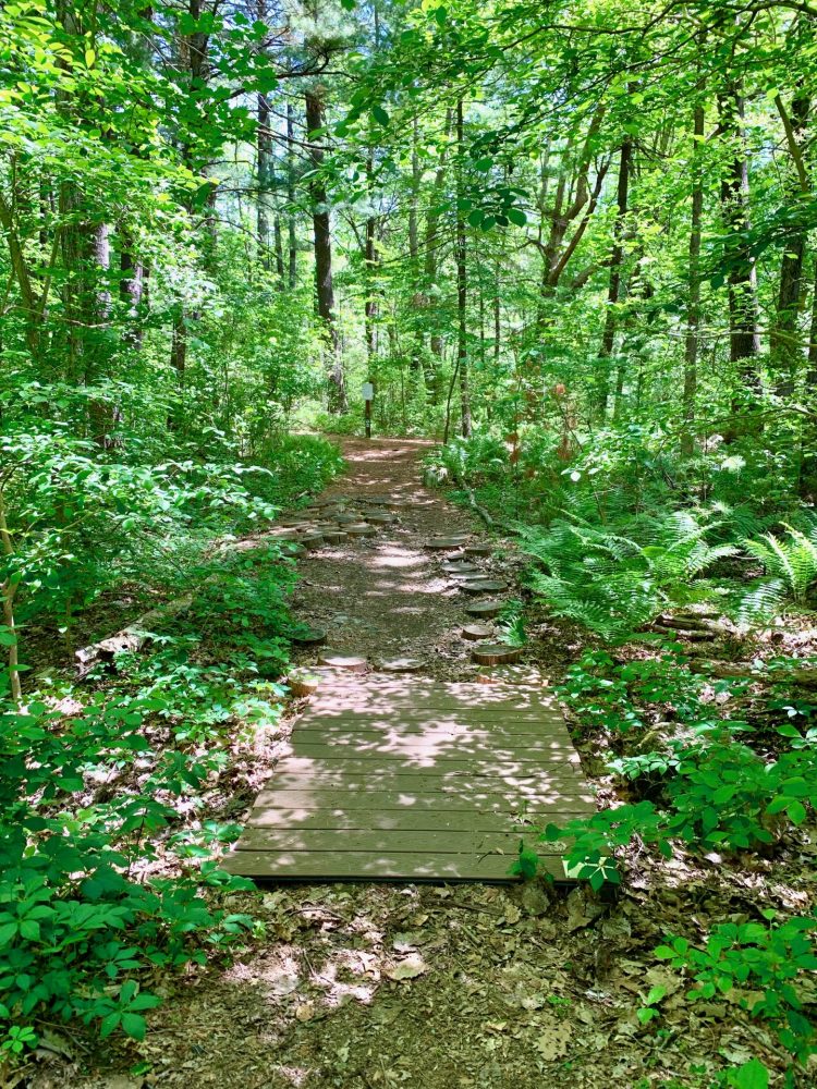
Start your hike at the entrance point that’s on the same side of the road as the parking lot. At the Guernsey Sanctuary sign, bear right and look for a short wooden bridge that spans a currently dried-up brook bed.

From the bridge, step directly onto the stump rounds if it’s muddy or if you’d just like to have a bit of fun hopping from one round to the next. The “tree cookies,” as they’re sometimes called, were in 2020 sliced by Wellesley Conservation Land Trust volunteers from the trunks of fallen trees, and strategically placed as a nature-based solution to the mucky conditions that are often part of a Guernsey Sanctuary hike. Because the walking path rings a marsh, all it takes is a little rain to turn parts of the trail into a mud slick. The addition of the tree cookies encourages hikers to keep to the path instead of veering off-trail and trampling ecologically sensitive areas in an effort to keep footwear mud-free.

Shortly after the bridge, at the “Guidelines for Sanctuary & trail use” sign, go right. Soon after that you’ll pass a sanctuary access point in Needham at the end of the Locust Lane cul de sac in Needham.

Technically speaking
If you can’t fathom so much as a casual stroll without fiddling with your phone, the Wellesley Conservation Land Trust has you covered. The Trust in 2019 brought technology to the Guernsey Trail with the addition of QR-codes at strategic spots along the one-mile circular trail. Support for the project was provided by the Wellesley Turkey Trot Foundation, and naturalists Bill Geizentanner of Wellesley and Ted Elliman of Sherborn, who conducted a botanical inventory of the area and identified 72 specimens and special places along the trail to be featured. Each of these features has a QR-code metal marker that identifies common and scientific names of the selected specimens and places, as well as information about various plants, trees, and water features along the trail. I tried out a few of the markers. Sometimes the QR codes worked for me, sometimes not. Success likely varies based on individual phone coverage.
Looking up from my phone I was rewarded, after an easy climb to the top of a slight rise, by a view of Sabrina Lake. (Landmark: a white house with a red roof sits directly across this narrow part of the lake.) The 18-acre privately owned body of water is approximately 1/2 mile long from north to south. Its deepest point is 10 feet, roughly in the center of the pond.